In words
Geological mapping involves recording and describing the geology of an area. A geological mapping is based on literature research, field surveys and field measurements. During fieldwork, exploration is only carried out to a maximum depth of 1 m below ground level. If the subsurface cannot be described on the basis of exploratory excavation.
Part of the literature research is among other things:
- Review of existing geological maps, explanations and topographic profiles.
- Evaluation of digital terrain models
- Evaluation of historical/current aerial photographs (orthophotos)
Part of the terrain survey is among others:
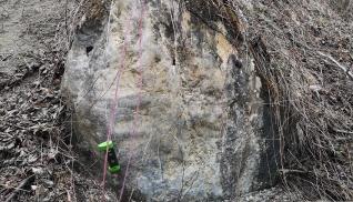
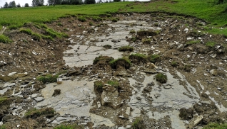
- geomorphological observations (e.g., landforms, slope movements, flow and fall paths)
- vegetation (e.g., crescent growth, wetland plants)
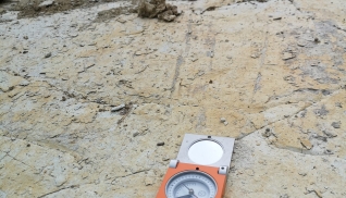
- lithological units
- structural geologic elements (e.g., interface structure)
- hydrogeologic framework (e.g., springs, receiving waters)
- in-situ experiments (e.g. determination of friction angle)
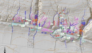
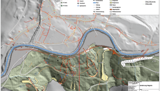
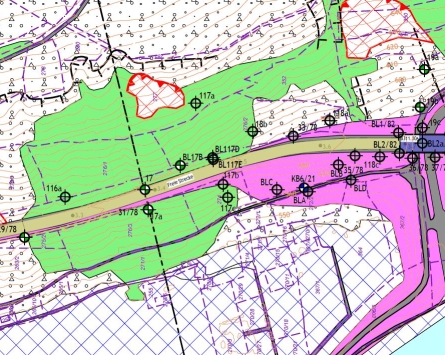
The result of the field work and data collection is an engineering geological map of the area in question, which can be transformed into a geological-geotechnical subsurface model by subsurface investigations. Scale and level of detail depend on the project size and requirements.
In pictures